Presentation About Geodesy Science
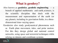
The science of geodesy. The purpose and tasks of the work. The purpose Present the. What is geodesy? Also known as geodetics, geodetic engineering — a branch of applied mathematic and earth sciences. Geodesy tools. In geodesy you must to know how to use many tools. Gps. The gps is. Gps tools. Theodolite. Theodolite is a precision instrument for measuring angles in the horizontal and vertical planes. Level. Level is a. How to become a geodesist? To become a. To summarize everithing this study programme is really complicated and hard. Findings. Geodesy - a science exploring the shape of the Earth.
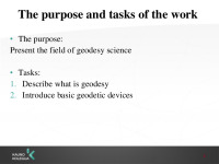
The purpose: Present the field of geodesy science Tasks: Describe what is geodesy Introduce basic geodetic devices.
In geodesy you must to know how to use many tools, but we gonna show you, how the main tools looks like.
To become a geodesist you must finish geodesy program course in Kaunas university of applied sciences college. It takes four year of exhausting study. There you learn how to measure survey levels, how to design plans, how to use AutoCAD and many other interesting things. But it is not enough... Also you must pass surveyor‘s courses, and get a license. And only than you are full-fledge surveyor.
To summarize everithing this study programme is really complicated and hard. But despite that you get useful knowledge, experience and skills. Surveyor‘s job is well-payd aswell. So we are happy that we chouse this study programe and we hope we gonna be really good surveyors in the future.
- Geology Presentations
- MS PowerPoint 1032 KB
- 2019 m.
- English
- 13 pages (505 words)
- College
- Viktorija


